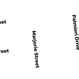
13 MARJORIE ST
Owner Information
MARIA F MOURA
13 MARJORIE ST
HUDSON, MA 01749


Property Details
13 MARJORIE ST is classified as a Single Family Residential (Raised ranch).
The primary structure on this property was built in 1989. There are 2,690ft2 of built area within this property. There is 2,106ft2 of residential/living space within this property. This property is listed as having 7 rooms.
13 MARJORIE ST is valued at $388,600. The land is valued at $119,900 and the structures are valued at $268,700.
This property is in Zone SA8. Confirm with local Zoning Board authorities to ensure there are no overlays or other easements on this property.
The most recent deed for 13 MARJORIE ST is recorded at the local registrar in Book 72195, Page 301. 13 MARJORIE ST was last sold on Monday, February 4, 2019 for $1.
Assessment data from fiscal year 2021.
Flood Data
According to the FEMA National Flood Hazard Layer, this property does not appear to be in a flood zone. It may also be in an area not yet reviewed. Nonetheless, confirm this information prior to taking any action.
To view the flood hazards around this property, create a FEMA "Firmette" Map of the area around 13 MARJORIE ST.
Broadband Internet Providers
| Provider | Type | Bandwidth (mbps) | |
|---|---|---|---|
| GCI Communication Corp. | Satellite | 0 | 0 |
| VSAT Systems, LLC. | Satellite | 2 | 1 |
| Comcast | Cable | 1000 | 35 |
| HughesNet | Satellite | 25 | 3 |
| Viasat Inc | Satellite | 100 | 3 |
| Verizon New England Inc. | DSL | 10 | 1 |
| Verizon New England Inc. | Fiber | 940 | 880 |
Broadband service provider data from December 2020.
Adjacent Properties
- MARJORIE ST
Undevelopable Residential Land owned by PIMENTA ADRIANO - LOIS ST
Undevelopable Residential Land owned by PIMENTA ADRIANO - PALMIERI DR
Vacant, Tax Title/Treasurer owned by TOWN OF HUDSON - TILTON ST
Vacant, Selectmen or City Council (Municipal) owned by TOWN OF HUDSON TOWN HALL - 17 MARJORIE ST
Single Family Residential owned by IDIONE DE SOUZA